
NOAA | 5 August 2026
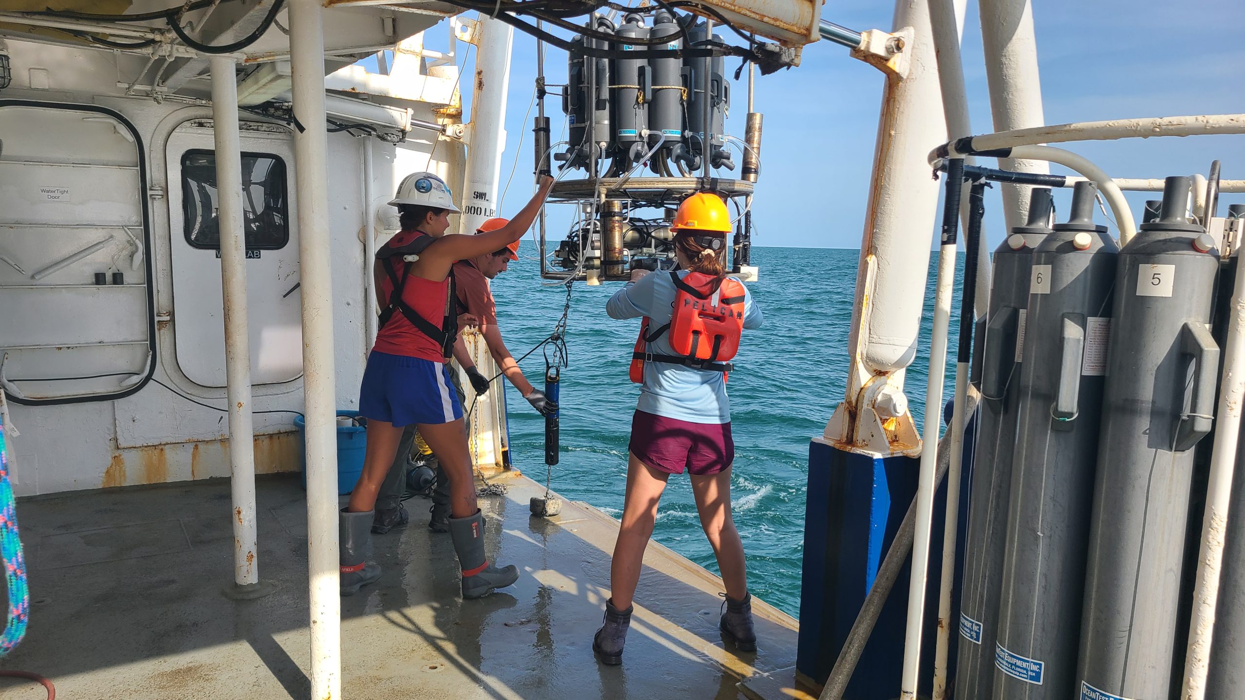
Measuring a 'dead zone': Scientists and Marine Technician (Abby Roche, Margaret Gaspar, and Max Newman) retrieve the CTD (conductivity, temperature, depth) package of ocean sensors after profiling dissolved oxygen at a station during the Shelfwide Hypoxia Cruise in the Gulf of America. (Image credit: Courtesy of Cassandra Glaspie/LSU)
NOAA-supported scientists announced today that this year’s Gulf of America hypoxic zone is approximately 1,332 square miles, making it the 2nd smallest zone on record in 40 years of measurement. Hypoxic areas, also called “dead zones,” are areas with little to no oxygen in the water, which can negatively impact fish, shellfish, corals and aquatic plants by making critical habitat unavailable to bottom species.
The annual hypoxic zone survey was led by scientists at Louisiana State University and the Louisiana Universities Marine Consortium (LUMCON). The survey cruise was conducted aboard the LUMCON research vessel Pelican from July 24-30. Data from the survey is available online for the public.
The measured hypoxic zone is smaller than anticipated this year due to Tropical Storm Bertha passing through the northern Gulf of America on the eve of the cruise. Tropical storm-force winds and high waves churned the water across the cruise area and mixed oxygen-rich surface waters down to the seabed. Although the cruise did not capture the full extent of the zone, years with abnormal weather events help researchers better understand how these events impact the breakup and reformation of hypoxia in the Gulf and ultimately lead to better models and forecasts.
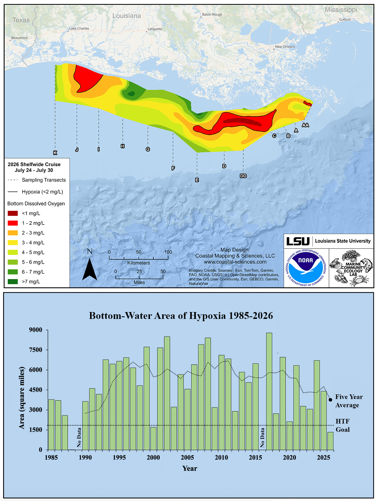
Top figure: A map of the measured Gulf of America hypoxia zone, July 24-30, 2026. Red area denotes 2 mg/L of oxygen or lower, the level which is considered hypoxic (i.e., having inadequate oxygen levels) at the bottom of the seafloor. (Bottom) Long-term measurement of the Gulf hypoxic zone (green bars) as found during ship surveys conducted since 1985, including the target goal established by the Mississippi River/Gulf of America Hypoxia Task Force and the 5-year average size (black dashed lines). (Image credit: NOAA and LSU)
“Measuring the hypoxic zone provides more than just a score card of the Gulf’s ocean oxygen levels — it helps us better understand the interconnectivity of our nation’s land, waterways and ocean,” said Timothy Petty, Ph.D., NOAA assistant secretary of commerce for oceans and atmosphere, and deputy administrator. “The data we’ve gathered from 40 years of measurements in the region will help inform the development of better management strategies upstream as part of our ongoing efforts to mitigate future impacts in the Gulf.”
The information helps scientists and coastal managers understand how low-oxygen events impact the overall growth, reproduction, and habitat usage of key fisheries and help develop mitigation measures to alleviate potential damage to affected commercial and recreational fishing industries and tourism.